East Yorkshire is in a northern sacrifice zone
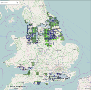
Prospective shale areas in the UK mainly occur in 2 parts of the country – the Weald Basin in the south; and the Bowland Shale across the middle of the north of England.
Or, according to Lord Howell: the tory voting areas in the south where fracking would cost the conservative party votes; and the “desolate north“.
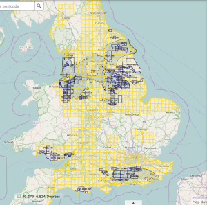
60% of the UK was offered to oil & gas companies in the 14th round of on-shore licensing by the Oil and Gas Authority.
The licence blocks are mainly 10km x 10km squares based on the Ordnance Survey grid.
However, the areas offered are not evenly distributed throughout the country.
Some companies claim to be only interested in conventional fossil fuels, and adamantly insist they have no interest in shale gas. Given this, the licences under consideration seem remarkably aligned with the areas of prospective shale.
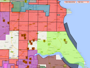
Virtually the whole of our region is being licensed, from the North York Moors to to Spurn Point; from the Peak District out to the coast.
We’re in the middle of some quite nasty stuff here.
To the west and south we have plans for Coal Bed Methane (CBM). This is a means of extracting gas from coal which cannot be mined conventionally. It happens closer to the surface, and often involves fracking. more…
There are already licences in the Humber Estuary and off the coast for Underground Coal Gasification (UCG). This hellish sounding process is another form of unconventional extreme fossil fuel extraction. It involves setting the coal on fire underground and attempting (but often failing) to control the combustion, producing a highly toxic gas fuel. more…
The Yorkshire Wolds, across the north of East Yorkshire, is prospective shale gas, extracted by High Volume Hydraulic Fracturing.
About the only area not to be licensed covers the Dalton Estate, home to the 18th baronet Lord Hotham. But that’s surely just coincidence.
Useful Interactive Maps
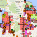
Frack Off Interactive Map of licence areas, active well sites, community resistance groups, companies and more.

Oil & Gas Authority map – licence areas & dates, prospective shale, historic & active wells. Use ‘Layers’ to select the information to display.
Holderness – Rathlin Energy UK Ltd
PEDL183 is the largest existing Licence Area in the UK, covering Holderness and beyond – from Beverley and Hornsea right down to Spurn Point.
It was awarded to Rathlin Energy UK Ltd in 2008, has 3 wells sites, and plans for 6 more.
Read more…
The Yorkshire Wolds – Cuadrilla, Ineos
This area has been offered to infamous fracking company Cuadrilla Resources. Further north, towards Ryedale, goes to Ineos. Ryedale already has a fracking application at Kirby Misperton, next to Flamingo Land, by existing licence holder Third Energy. Read more…
Hull
Hull City Council opposes fracking, on grounds of water use and contamination, traffic, hazardous waste, seismic activity, climate change, and other impacts. It will take steps to protect the City, its residents and businesses. Read more…


